Monsoon storms bring dust, rain to Phoenix area Saturday
After experiencing a number of storms over the week, Phoenix-area residents were in store for another on Saturday, with dust storm advisories hitting the area.

After experiencing a number of storms over the week, Phoenix-area residents were in store for another on Saturday.
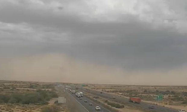
The National Weather Service issued a dust storm warning for both Maricopa and Pinal counties until 6:43 p.m with visibility falling near or below one mile in spots.
600pm: Large area of dense blowing dust entering the southern edges of the Phoenix metro. Visibility less than 1/4 mile in spots. Pull Aside, Stay Alive. #azwx pic.twitter.com/5mhCfezl5g
— NWS Phoenix (@NWSPhoenix) July 15, 2018
NOW: Dust is clearly visible from our traffic camera on I-10 and Wild Horse Pass. #azwx #PullAsideStayAlive pic.twitter.com/A9QqqQPVSe
— Arizona DOT (@ArizonaDOT) July 15, 2018
Phoenix, Scottsdale, Carefree and Deer Valley Airport were said to be areas that could see rainfall, with a flash flood warning issued for Maricopa County. It began at 3 p.m. and was expected to end at 6 p.m.
Flash Flood Warning including Maricopa County, AZ until 6:00 PM MST pic.twitter.com/ClxGcXjhIZ
— NWS Phoenix (@NWSPhoenix) July 14, 2018
Bringing with it heavy rain, winds in excess of 30 mph and dime-sized hail, the storms were near Cave Creek and New River around 1:45 p.m.
145p: Storm near New River/Cave Creek producing heavy rain and small hail! Heads up. #azwx pic.twitter.com/6AynKhNDb0
— NWS Phoenix (@NWSPhoenix) July 14, 2018
“They may drift into parts of the metro [Phoenix area], probably most people won’t see rain out of this, but there will be some people that see a little bit of rain and some gusty winds this evening,” National Weather Service meteorologist Mark O’Malley told KTAR News 92.3 FM.
Some residents in the Anthem-Cave Creek area may also experience some “nuisance flooding” due to the slow-moving storms in the area as well.
208p: Nearly stationary storms will cause at least some nuisance flooding in the Anthem-Cave Creek area including the 17. #azwx pic.twitter.com/swo2Dte5k0
— NWS Phoenix (@NWSPhoenix) July 14, 2018
“So far, there’s been a little more than half an inch in the last hour and we expect some of the washes to begin flowing so we want people driving with caution in that area,” O’Malley said.
Drivers should use caution when using Interstate 17 between mile markers 220 and 231.
Motorists should also be careful while on U.S. 60.
300pm: Strong storm south of Wickenburg drifting southeast. Watch out motorists along US-60. #azwx pic.twitter.com/ASvCihQu2I
— NWS Phoenix (@NWSPhoenix) July 14, 2018
Phoenix-area residents saw a number of storms over the week.
From Monday to Wednesday, the Valley had three consecutive days of rain.
But while this week’s weather has wreaked havoc with downed power lines and flash flooding, a dip in temperatures has been a welcome effect.
The forecast for Saturday called for a high of 103 with a low of 86 in Phoenix.
The monsoon season officially kicked off June 15.
Related
 U.S. Sen. Ruben Gallego says he’s considering running for president
 Sen. Mark Kelly proposes 2 bills to support young men and grow public service
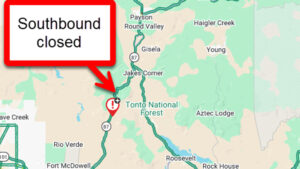 SR 87 reopens northeast of metro Phoenix after vehicle fire
 Weekend construction closes lanes on four Valley freeways
 Lawsuit challenges validity of thousands of ESA reform ballot measure signatures
 Kimberly Yee outlines education priorities after GOP primary win

Comments