
National Weather Service cancels flood watch for parts of Valley
The National Weather Service tweaked a flash flood watch Monday for the Phoenix area that was supposed to run to the following day.

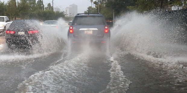
(AP Photo/Ross D. Franklin)
(AP Photo/Ross D. Franklin)
PHOENIX — The National Weather Service tweaked a flash flood watch Monday for the Phoenix area that was supposed to run to the following day.
Just one day after issuing the watch through Tuesday evening, the weather service instead cancelled the watch for lower elevations of south central and southwest parts of Arizona on Monday night after the storm took a slight turn to the east near the Arizona-Mexico border.
Officials said the flood watch still remained for areas of higher terrain in south central Arizona until Tuesday morning.
Flood Watch cncld for lwr elvtns of scntrl & sw AZ & se Cali. But Flood Watch continues ovr higher terrain of scntrl AZ til tmrw mrng. #azwx
— NWS Phoenix (@NWSPhoenix) September 22, 2015
The flash flood watch was issued ahead of a tropical depression that entered the state from the south on Monday.
Hector Vasquez, a meteorologist with the National Weather Service, said the storm was expected to bring a warm rain to Phoenix beginning in the afternoon.
“We will get general rainfall Monday, and possibly very heavy Monday night,” he said. “The bulk of the moisture will sheer off and move to the northeast on Tuesday.”
Severe weather could delay bus services. https://t.co/J0chMP29P1
— PHX Public Transit (@PhoenixMetroBus) September 21, 2015
Several cities were offering sandbags for flood-prone residents:
• Tempe
• Phoenix
• Goodyear
• Surprise
• Buckeye: Sandbags available at 432 Arizona Eastern Avenue
A second storm is expected to enter the state from the west on Tuesday. The forecast called for a 70 percent chance of showers and heavy rain through Tuesday morning, with the likelihood of rain dropping through the evening.
The storms will cool things off in Phoenix. Wednesday’s high should be about 92 degrees but the mercury will again be flirting with the triple digits by the weekend.
Related
 What attendees should know for the USMNT vs. Mexico soccer game at State Farm Stadium
 Trump urges calls to Arkansas Sen. Tom Cotton in push for permanent daylight saving time
 Man, woman seriously injured in shooting at Scottsdale home
 Arizona Corporation Commission issues cease-and-desist order against stablecoin sellerGovernor says Tennessee’s prisons chief is resigning after failed execution of Christa Pike
 A $28B hemp THC industry is fighting to save itself from a looming federal ban

Comments
0 Comments