
Spotty monsoon storms could move into Phoenix area tonight
Monsoon chances stay limited Tuesday, but overnight activity could bring lightning, gusty winds and brief heavy rain to parts of the Valley.

Watch: Will Middle East chaos send inflation skyrocketing again? | 9 mins
The best chance for monsoon storms to reach the Valley is late Tuesday night into early Wednesday morning, according to the National Weather Service in Phoenix. Daytime storm chances remain limited.
Storms are expected to develop mainly over the higher terrain and southeastern Arizona Tuesday afternoon, similar to recent days. Some of that activity could drift toward the south-central Arizona lower deserts, including the Valley, later in the evening or overnight.
High terrain & SE AZ thunderstorm development this afternoon should be fairly similar to the last few days, however, the South-Central AZ lower deserts may not see as much activity until the overnight period into Wednesday morning. Remain weather aware! #azwx #cawx pic.twitter.com/U1MyS3MJBm
— NWS Phoenix (@NWSPhoenix) August 11, 2026
Forecasters said storm coverage in the Phoenix area is expected to be spotty, but any storms that do develop could bring lightning, brief heavy rainfall and gusty winds. A few areas could see localized downpours, though most spots are expected to receive little or no rain.
Storm chances are expected to be higher Wednesday, especially from northern and eastern parts of the Valley into the higher terrain. Locally heavy rain and gusty thunderstorm winds will remain possible through Thursday.
That storm activity will bring with it a welcome break from the heat, as temperatures are expected to drop below normal on the back half of the week.
Related
 Thunderstorms outside Valley bring dust, winds to Phoenix metro area
 Back-to-back haboobs blanketed Phoenix with dangerous levels of dust
 More storms possible in Phoenix area after damaging night
 Severe weather with dust, rain rolls into Valley Sunday night
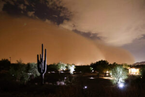 Phoenix hit by twin category 5 haboobs this week, a first in 16 years of records
 Dust storm sends Phoenix air quality to dangerous levels, with more on the way

Comments
0 Comments