
More rain, snow expected to fall in Arizona on multiple days this week
Two winter storm systems are expected to produce significant rain and snow across Arizona over multiple days this week.


(Pexels photos)
(Pexels photos)
PHOENIX – If you enjoyed the rain and snow that fell across Arizona last week, you’ll love the forecast for this week.
That’s because two winter storm systems are expected to produce significant precipitation for a good portion of the state over multiple days.
Metro Phoenix will start the week with a day of clear skies and above-normal temperatures in the low 80s on Monday.
“But then after that, we’re going to see an unsettled weather pattern prevail across the region,” Isaac Smith of the National Weather Service (NWS) in Phoenix told KTAR News 92.3 FM on Monday morning.
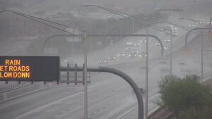
The Valley forecast calls of highs in the upper 70s on Tuesday, but the week’s first winter storm is expected to roll in as the day progresses. By Tuesday night, the chance for rain will be up to 90%.
Most of the Phoenix area can expect to see between 0.25 and 0.4 inches from this system, with heavier local amounts if thunderstorms develop, Smith said.
Wednesday will bring a 30% chance for more showers in the morning and high temperatures of around 70 degrees in the afternoon.
Two separate storm systems will progress through our region this week.
Storm #1: Will arrive late Tuesday, bringing a round of widespread rain showers. Rainfall amounts will vary from 0.01"-0.40" across the lower deserts with locally higher amounts NE of Phoenix. #azwx #cawx pic.twitter.com/5wdBic2XsR
— NWS Phoenix (@NWSPhoenix) March 10, 2025
Phoenix area can expect another winter storm on Thursday
But a second, colder front is due to hit the Valley on Thursday, when the chance for rain is 80% and temperatures are expected to peak in the middle 60s.
That system is projected to produce wind gusts of up to 30 mph and between 0.25 and 0.5 inches of rain. The disturbance is due to clear out by Friday, which is expected to be mostly sunny with a chilly high temperature of around 60 degrees.
How much has it rained in Phoenix in 2025?
The late winter wet spell is much needed in Phoenix, which is far behind its normal rainfall totals for early March.
Thursday’s storm dropped 0.39 inches on Phoenix Sky Harbor International Airport, which the NWS uses for the city’s official readings, pushing the total for 2025 to 0.42 inches.
“To put that in context, normally we have just a little over 2 inches of rainfall up to this point in the year,” Smith said. “So, we are more than an inch-and-a-half below normal.”
What’s in this week’s forecast for northern Arizona?
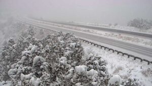
Meanwhile, northern Arizona can expect more snow this week getting blanketed by 12-20 inches Thursday and Friday in elevations above 6,000 feet.
About 1-2 inches of snow is expected Tuesday night through Wednesday morning in elevations above 6,000 feet in Flagstaff and to the south.
However, a bigger winter storm is expected to bring heavy snow to northern Arizona starting Thursday night. Justin Johndrow of the NWS in Flagstaff said snow levels could drop to as low as 4,000 feet by Friday morning.
A low pressure system will bring rain & snow showers late Tuesday afternoon into Wednesday. A second much stronger/colder storm is forecast Thursday stretching into early Friday, with a potential for heavy snow in the high country & lighter snow as low as 4000 feet. #azwx pic.twitter.com/giDlmiiKtu
— NWS Flagstaff (@NWSFlagstaff) March 10, 2025
“Even with the heavy snow, the snowpack for early March is still well below where it should be for this time of year,” Johndrow said.
Last week’s winter storm created dangerous driving conditions, leading to road closures in northern Arizona that lasted up to 12 hours. Drivers should anticipate a repeat later this week.
“It’s probably a good idea to reconsider travel plans for Thursday and early Friday around this area,” Johndrow said.
KTAR News 92.3 FM’s Colton Krolak contributed to this report.
Related
 Multiple highways leading toward Flagstaff temporarily closed for winter weather conditions
 Phoenix experiences its wettest day in months as cold front arrives
 Weather knocks out power at thousands of Valley homes, impacts Sky Harbor flights
 KTAR Weather Center: Forecast, maps, latest news
 New Grand Canyon flood damages water system crews were rebuilding after deadly storm
 Tropical storm soaks Phoenix’s east side, turning streets to streams

Comments
2 Comments
More of the undeniable effects of climate change. Back in the day we called it a storm, but that wasn't dramatic enough to promote people to shelter in place.
Why do other forecasting models show no rain until Thursday 3/13/2025?