
Storm system rolls through Valley, bringing small amounts of rain
If you saw wet stuff on the street, you weren't going crazy: It rained throughout the Valley on Tuesday, leaving behind soggy streets and wet umbrellas.

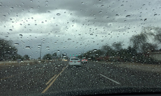
PHOENIX — If you saw wet stuff on your street, you weren’t going crazy: It rained throughout much of the Valley on Tuesday, leaving behind soggy streets and wet umbrellas.
According to the Flood Control District of Maricopa County, it only rained four- to eight-hundredths of an inch in the Phoenix-area, but it was enough to get people noticing.
925PM #Phoenix Sky Harbor Airport has received 0.03 in. of rain so far today. There's still more rain scheduled for tonight. Check out these rainfall reports from across the region and tonight's radar. #AZWX #CAWX https://t.co/nh8VWShyja pic.twitter.com/DTaqubIpis
— NWS Phoenix (@NWSPhoenix) February 28, 2018
The rain started just before 5 p.m. and continued throughout the night, with forecasts saying it would pick back up overnight.
In parts of the North Valley, residents saw upwards of two-tenths of an inch of rain, while the South Valley saw measurements closer to .12-inch.
The rain is here. Careful out there. Showers in the west valley. #azwx #rainycommute #azweather pic.twitter.com/rjIqJguUIo
— KTAR News (@KTAR923) February 27, 2018
Raining in West Phoenix. @KTAR923 @DetourDanKTAR pic.twitter.com/GOrdIGNKVh
— Bob McClay (@BobMcClay) February 27, 2018
It's a soggy commute for many this evening! The is a look at I-17 and Jomax. #PhxTraffic #azwx pic.twitter.com/qYyacNwqx4
— Arizona DOT (@ArizonaDOT) February 28, 2018
Phoenix Sky Harbor tweeted that those planning on travelling on Tuesday should check their flight status, as delays could be expected due to the weather.
Remember to check your flight status. There could be possible delays due to weather.
— PHX Sky Harbor (@PHXSkyHarbor) February 28, 2018
But the Valley was not the only area in Arizona expected to see a change in weather: A storm dropped snow on higher elevations across a broad swath of Arizona extending from the Utah line on the north to the U.S.-Mexico border in the southeast.
Communities covered by winter weather messages issued for Tuesday night and Wednesday morning included Flagstaff, Show Low and Sierra Vista.
We starting to see winter weather return on I-40 near Williams. #azwx pic.twitter.com/Xjv4bgHGDh
— Arizona DOT (@ArizonaDOT) February 28, 2018
@NWSFlagstaff is still calling for snow to move through our region overnight through Wednesday morning.
Watch for strong winds and blowing snow during evening/night commutes.
Accumulation is projected to be highest along the Mogollon Rim. pic.twitter.com/fShAsgn3dD
— Navajo County (@NavajoCountyAZ) February 28, 2018
Snow is accumulating on I-17 at Munds Park. #Snowplows will be out until the roads are cleared. Mark Trennepohl, ADOT’s statewide road weather manager, takes us south on I-17 in this video. pic.twitter.com/krDoyBwfnz
— Arizona DOT (@ArizonaDOT) February 28, 2018
Expected snowfall amounts included up to 5 inches (13 centimeters) in Flagstaff, up to 4 inches (10 centimeters) in Show Low and up to 3 inches (8 centimeters) in Sierra Vista.
National Weather Service meteorologists predicted up to 3 inches of snow for areas up to 6,000 feet in elevation with up to 7 inches for areas above the 6,000-foot level.
The Flagstaff Unified School District also said Tuesday that all of its schools would be on a 2-hour delay on Wednesday due to weather.
The Associated Press contributed to this report.
Related
 Amish Shah says he would find ways to work with Trump administration if elected
 Northbound Loop 101 Pima Freeway reopens near Tempe-Scottsdale border after crash
 ‘Really hypocritical’: Jay Feely hits Amish Shah on data centers but agrees on water policy
 Pinal County Sheriff’s Office investigating death of 19-year-old man
 WATCH: Jay Feely, Amish Shah debate differing visions for Arizona 1st Congressional District
 Police investigating after early-morning shooting in Phoenix leaves 2 men dead

Comments
0 Comments