
Dust storm, thunderstorm activity approaches Phoenix area
Weather officials expect a wall of dust to appear, and visibility will also drop to under 1 mile.

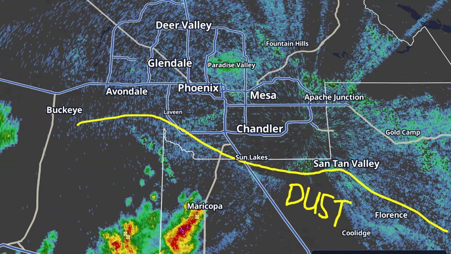
Weather officials expect a wall of dust to appear, and visibility will also drop to under 1 mile. (NWS/Phoenix)
(NWS/Phoenix)
A dust storm and thunderstorm activity approached the Phoenix Metro area from the south on Sunday evening, according to the National Weather Service.
Weather officials expect a wall of dust to appear, and visibility will also drop to under 1 mile.
8:05 PM MST: A strong outflow boundary is now approaching the Phoenix Metro area from the south. Expect a wall of dust with visibilities briefly dropping below 1 mile. #azwx pic.twitter.com/k5viCP7bKv
— NWS Phoenix (@NWSPhoenix) August 31, 2026
In addition, NWS issued a severe thunderstorm warning for Phoenix, Chandler and Gilbert until 9:15 p.m. Pea-sized hail is a possibility, and wind gusts can reach up to 60 mph, NWS said.
Severe Thunderstorm Warning including Phoenix AZ, Chandler AZ and Gilbert AZ until 9:15 PM MST pic.twitter.com/yvXH62F51y
— NWS Phoenix (@NWSPhoenix) August 31, 2026
The Valley was yet to receive measurable rain Sunday evening as of 8:30 p.m. A flood watch remains in effect until Monday morning.
Related
 Snowbowl gets 2 inches of early-season snow
 Phoenix surpasses normal monsoon season rainfall total with late surge
 Thunderstorms create hazardous driving conditions across Phoenix area
 Driver safely escapes after truck gets swept away in north Valley floodwaters
 Thunderstorms cause ground delay for Phoenix Sky Harbor International Airport
 Phoenix offers free sand bags at 9 parks ahead of monsoon storms

Comments
0 Comments