
Thunderstorms create hazardous driving conditions across Phoenix area
Most of the Valley received measurable rainfall Tuesday morning, with more than an inch coming down in the hardest-hit areas.

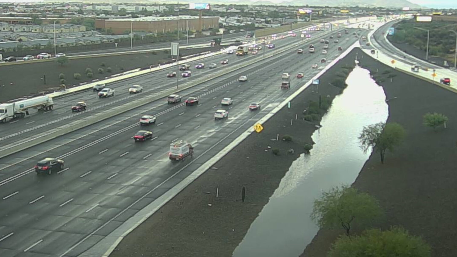
Thunderstorms created hazardous driving conditions for commuters across the Phoenix area on Tuesday morning. (ADOT photo)
(ADOT photo)
Potent thunderstorms developed across the Phoenix area on Tuesday morning, creating hazardous driving conditions for commuters.
The rain left Valley roadways slick and made some areas impassable because of standing water.
Areas of showers and storms continue across the region, with the heaviest activity now moving into the higher terrain areas east of Phoenix. If driving out there, please exercise caution, especially along low-water crossings! #azwx pic.twitter.com/syfcZLLofN
— NWS Phoenix (@NWSPhoenix) September 29, 2026
Meteorologist Matt Salerno of the National Weather Service in Phoenix said he expected the storms to continue through midmorning.
“Be very careful out on the roads this morning. There could be some periodic heavy rainfall, which could lower your visibility as you’re driving around. And just avoid the low-water crossings,” Salerno said.
The storms caused a ground delay at Phoenix Sky Harbor International Airport and flooding that swept away two vehicles in New River.
Much of Arizona is under a flood watch Tuesday, and a flash flood warning was issued for the Cave Creek area until 9:30 a.m.
Most of the Valley received measurable rainfall, with more than an inch coming down in the hardest-hit areas.
The storms knocked out power for pockets of Salt River Project and Arizona Public Service customers, but the utility companies did not report any widespread outages.
KTAR News 92.2 FM’s Colton Krolak contributed to this report.
Related
 2 vehicles swept away in floodwaters north of Phoenix amid thunderstorms
 Thunderstorms cause ground delay for Phoenix Sky Harbor International Airport
 Phoenix offers free sand bags at 9 parks ahead of monsoon storms
 Phoenix forecast includes 2 rainy days, highs nearly 20 degrees below normal
 About 5,600 APS customers lose power in thunderstorms
 Thunderstorms disrupt travel at Phoenix Sky Harbor International Airport

Comments
0 Comments