
Flash flood warnings issued as storms develop across Phoenix area
A weather disturbance is expected to produce multiple rounds of storm activity across central and southern Arizona.

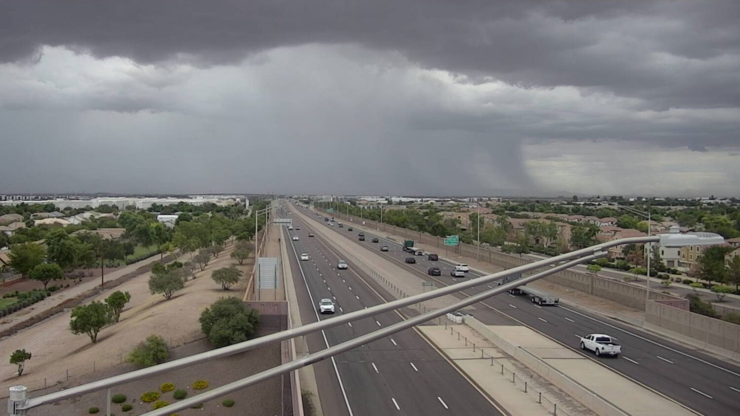
The Phoenix-area forecast for Wednesday includes rain and possible flooding. (ADOT photo)
(ADOT photo)
A weather disturbance capable of bringing multiple rounds of heavy rainfall to central and southern Arizona triggered a series of flash flood warnings on Wednesday.
“We have an environment that’s very suitable for very heavy rain,” Sean Benedict, a meteorologist with the National Weather Service in Phoenix, told KTAR News 92.3 FM.
Wed Sept 16, 2026 1155am Radar Update: Flash flood concerns increasing along Highway 238 between the City of Maricopa and Gila Bend. Strong thunderstorms with rainfall rates of 1-2 inches per hour are ongoing. Turn Around Don't Drown. Do not drive through flood waters! #azwx pic.twitter.com/ZkrQOL4IAI
— NWS Phoenix (@NWSPhoenix) September 16, 2026
As storms and showers started developing east of the Valley after 10 a.m., a flash flood warning was issued for parts of Gila County and far eastern Maricopa County south of Roosevelt Lake until 1:30 p.m.
Additional flash flood warnings were issued as rain started coming down in the East Valley and near Maricopa.
Flash Flood Warning including Maricopa County, AZ until 1:45 PM MST pic.twitter.com/lQhY9RR5rq
— NWS Phoenix (@NWSPhoenix) September 16, 2026
Flash Flood Warning including Maricopa County, AZ, Pinal County, AZ until 3:45 PM MST pic.twitter.com/SLOtnl2yve
— NWS Phoenix (@NWSPhoenix) September 16, 2026
Flash Flood Warning including Camp Creek AZ and Sunflower AZ until 3:30 PM MST pic.twitter.com/OexGCkLExh
— NWS Phoenix (@NWSPhoenix) September 16, 2026
Over an inch came down in a deluge near Falcon Field in Mesa during the 11 o’clock hour.
The weather service previously issued a flood watch across the Valley through 11 p.m. because of the potential for flash flooding.
“In addition to there being the flooding risk, can’t quite rule out the potential for some isolated severe storms in there,” Benedict said. “With all this moisture, you could potentially put down some wet microbursts that could lead to some damaging winds. So, looking like an active day.”
How much rain is expected Wednesday
Phoenix entered the day with a rainfall total of 1.41 inches for the 2026 monsoon season (June 15-Sept. 30), which is 0.77 inches below normal.
Wednesday’s rainfall totals will vary widely by location, but there could be enough to make up the seasonal deficit.
“The main reason why we have that flood watch in effect is because there’s indications that some areas could see very high rainfall amounts, even upwards of 3 to 4 inches,” Benedict said. “Just the average rainfall amount’s probably going to be more in that, maybe, half to an inch range around south-central Arizona, and then it drops off as you head west.”
KTAR News 92.3 FM’s Colton Krolak contributed to this report.
Related
 Flood watch issued ahead of possible storms in metro Phoenix
 Scattered storms move through parts of East Valley
 Monsoon activity approaches Valley as thunderstorm warnings issued
 Extreme heat warning issued for Tuesday-Thursday in metro Phoenix
 Monsoon activity could pick up heading into Labor Day weekend
 Rescuers saved some 80 people in Grand Canyon floods that left 2 dead and 1 missing, officials say

Comments
0 Comments