
Flood watch issued ahead of possible storms in metro Phoenix
The Valley forecast for Wednesday includes a 60% chance for rain in the morning and cooler temperatures.


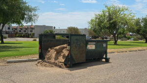
A flood watch covering a portion of south-central Arizona is set to run from late Tuesday through Wednesday evening. (Unsplash stock photo)
(Unsplash stock photo)
With possible thunderstorms in the forecast, the National Weather Service issued a flood watch for the Phoenix area.
The watch, which covers a portion of south-central Arizona, is set to run from late Tuesday through Wednesday evening.
There could be storm activity Tuesday afternoon and night, especially in the eastern high terrain. But the Valley is more likely to see rain on Wednesday, Alicia Ryan, a meteorologist with the National Weather Service in Phoenix, told KTAR News 92.3 FM.
“The peak seems to be Wednesday morning, where we might see some activity developing in the eastern Phoenix area and, again, in those higher terrains especially. We have around a 60% chance as the peak chances,” Ryan said Tuesday morning.
There could be more rain Wednesday afternoon if there’s enough moisture left in the atmosphere after the morning activity, Ryan said.
Increased shower and storm activity is expected over the next couple days across central and eastern AZ. With potential rounds of storms and high rain rates, flash flooding will become an increased threat. Stay tuned to the weather over the next 48+ hours. #azwx pic.twitter.com/t1CxGNU6XQ
— NWS Phoenix (@NWSPhoenix) September 15, 2026
“By Thursday, we should be drying out and seeing those chances starting to decrease as we head into the later half of the week [and] into the weekend,” she said.
The weather disturbance is expected to drop temperatures for a few days. The Phoenix forecast calls for highs of 90 degrees on Wednesday and 94 degrees on Thursday. The normal high for this time of year is about 100 degrees.
KTAR News 92.3 FM’s Colton Krolak contributed to this report.
Related
 Snowbowl gets 2 inches of early-season snow
 Phoenix surpasses normal monsoon season rainfall total with late surge
 Thunderstorms create hazardous driving conditions across Phoenix area
 Driver safely escapes after truck gets swept away in north Valley floodwaters
 Thunderstorms cause ground delay for Phoenix Sky Harbor International Airport
 Phoenix offers free sand bags at 9 parks ahead of monsoon storms

Comments
0 Comments