Wildfire burning southwest of Crown King grows to more than 4,000 acres
A wildfire burning seven miles southwest of Crown King that forced the evacuation of three nearby communities has grown to more than 4,300 acres as of Tuesday morning.


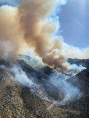
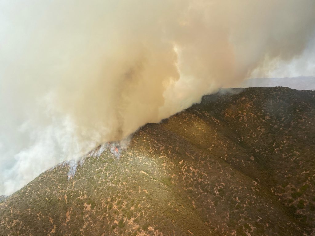
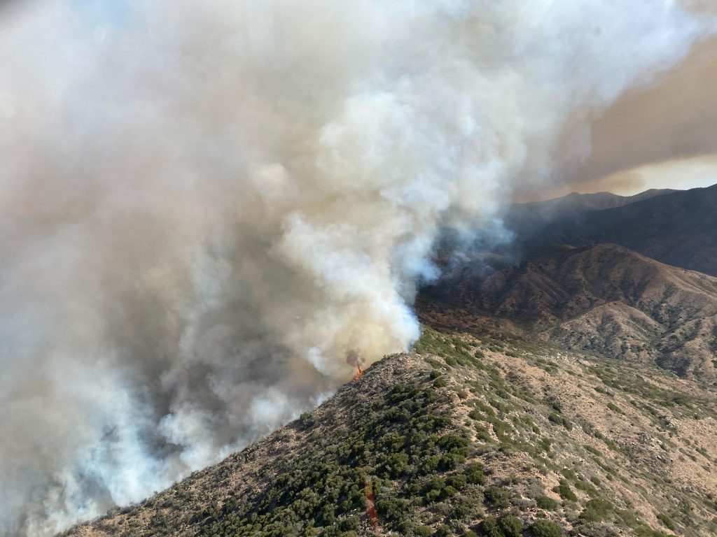
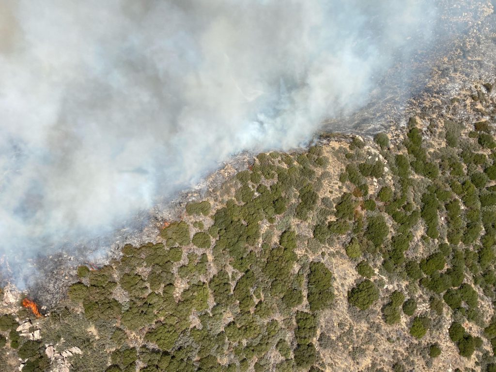
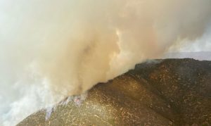
Tussock Fire (Facebook photo/Tussock Fire Information)
(Facebook photo/Tussock Fire Information)
PHOENIX — A wildfire burning seven miles southwest of Crown King that forced the evacuation of three nearby communities has grown to more than 4,300 acres as of Tuesday morning.
The blaze, known as the Tussock Fire, started Sunday around 2:15 p.m. and is up to 4,421 acres with no containment, according to InciWeb.
Evacuations remain in effect for Minnehaha, Fort Misery and Horse Thief Basin with Crown King residents in a “SET” status to be ready in the event an evacuation is ordered.
The town of Crown King has also been closed to nonresidents.
The Red Cross shelter that opened at Mayer High School for evacuations was closed Monday.
As of Tuesday morning, no structures have been destroyed by the fire, according to authorities.
A total of 230 personnel are working the wildfire, which was believed to be human-caused.
Road closures remain in effect for Old Senator Highway between Hooper Saddle and Crown King, along with the area of Cow Tank road that leads to FR 711 near Lake Pleasant.
Some forest roads in the area of Old Senator Highway at the junctions of FR 362 and FR 192 near Crown King have also been closed.
While the fire is visible from Interstate 17, there are no direct impacts or road closures on the highway.
The fire is one of four burning around the state.
The Associated Press contributed to this report.
Related
 Wildfire burning southwest of Crown King forces evacuations
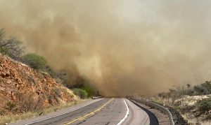 US 60 between Globe and Show Low back open after closure due to wildfire
 Annual fire ban set to begin in Maricopa County, Phoenix parks
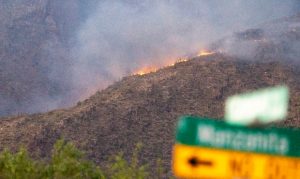 With wildfire season looming, Arizona officials urge public to be cautious
 Harry Mitchell, a former Tempe mayor, state lawmaker and congressman, dies at 86
 No charges against parents of Gilbert child found alive in morgue after being pronounced dead

Comments
0 Comments