
Multiple Valley roadways closed due to flooding as rain falls for 4th consecutive day
Multiple roadways were closed due to flooding Thursday morning as rain fell in metro Phoenix for a fourth consecutive day.

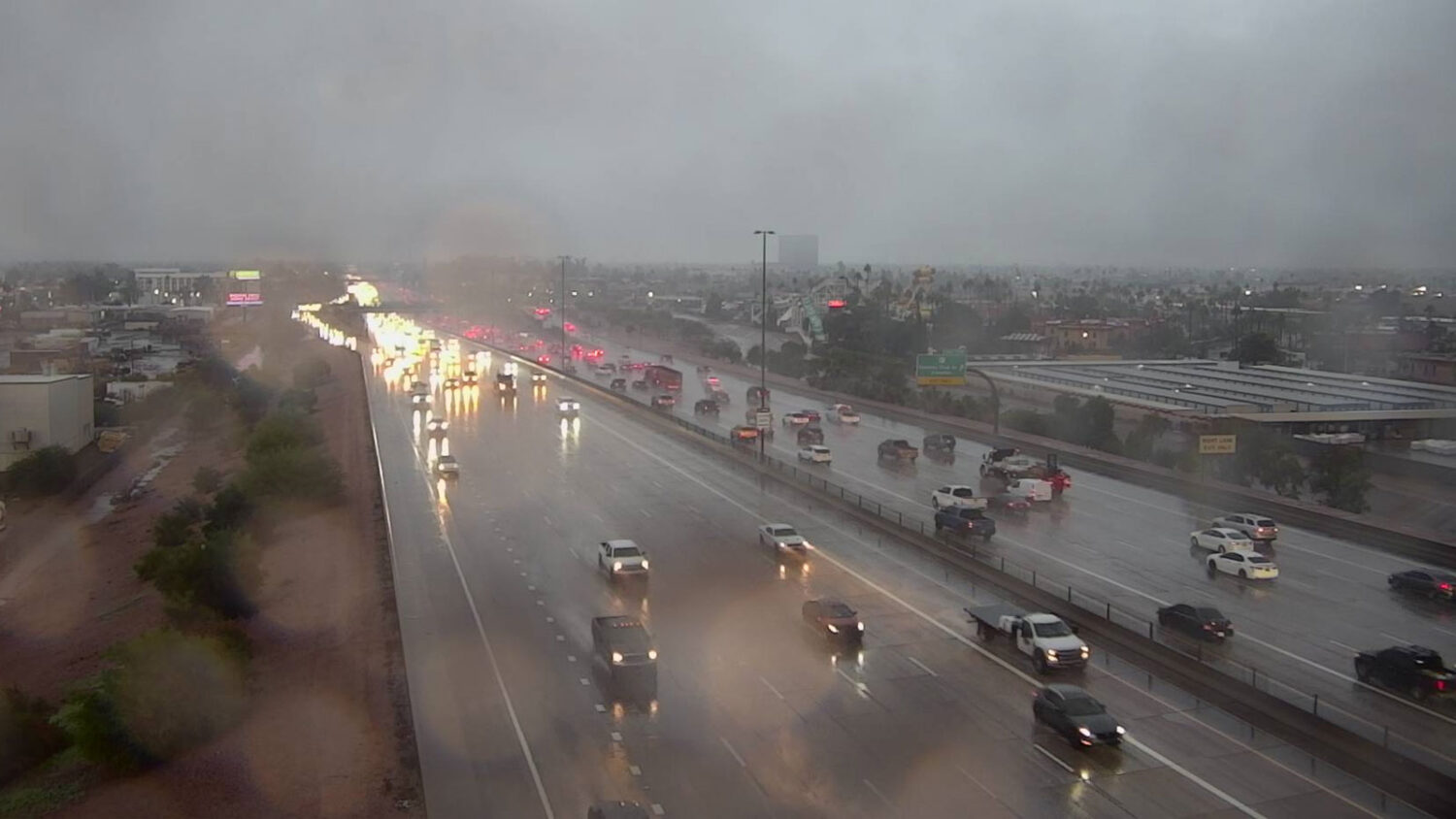
Multiple roadways were closed due to flooding Thursday morning as rain fell in metro Phoenix for a fourth consecutive day. (ADOT photo)
(ADOT photo)
PHOENIX – Multiple roadways were closed due to flooding Thursday morning as rain fell in metro Phoenix for a fourth consecutive day.
The following closures were reported by the Maricopa County Department of Transportation as of 6 a.m. due to water filling low-lying areas:
- Lower Buckeye Road in both directions between 127th Avenue and Fourth Street in Avondale.
- 19th Avenue in both directions between Desert Hills Drive and Irving Road in north Phoenix.
- Desert Hills Drive in both directions between 15th and 17th avenues in north Phoenix.
- 14th Street in both directions between Carefree Highway and Paint Your Wagon Trail in the north Phoenix area.
- Narramore Road in both directions between 214th and 215th avenues south of Buckeye.
- Southbound Tuthill Road between Ray Road and Waterman Wash south of Buckeye.
There was no estimated time for reopening the flooded roads.
Motorists are strongly advised to avoid driving into flowing water during storm activity. A 70-year-old man was still missing as of Thursday morning after his car was swept away by floodwaters in Cordes Lake in Yavapai County on Tuesday afternoon.
How long will the metro Phoenix rain continue?
Thursday morning’s rainfall, which was part of the tail end of the second storm system to move through the Valley in recent days, was expected to clear by midmorning.
Lingering light rain showers across central & eastern AZ will slowly come to an end today. Activity is expected to end across the Phoenix Metro by the mid-morning hours & across eastern AZ by late this afternoon. Additional rain: 0.00-0.25" locally higher amounts possible. #azwx pic.twitter.com/dEqT60TiIc
— NWS Phoenix (@NWSPhoenix) November 20, 2025
“After that, it’ll dry out here in the metro until that the third system moves through,” Katherine Berislavich of the National Weather Service in Phoenix told KTAR News 92.3 FM on Thursday morning.
The third system is expected to arrive as soon as Friday afternoon.
“But most of that activity most actually will probably stay dry through Saturday morning. It’ll probably just be very light, if anything,” Berislavich said.
Since the first system arrived late Monday, much of the Valley has received between 0.5 and 2 inches of rain, with totals higher in some areas.
Thursday’s early activity was heaviest in the East Valley, where totals were mainly between 0.2 and 0.5 inches. Central and north Phoenix also received widespread rainfall in the morning hours.
Phoenix Sky Harbor International Airport, which the NWS uses for the city’s official readings, has received over a third of an inch of rain since Monday night.
Thunderstorms developed Wednesday afternoon and evening, producing hail in some areas. Additionally, a brief funnel cloud was spotted in the Surprise area.
The NWS forecast for metro Phoenix includes a 20-30% chance for rain each day through Sunday, with high temperatures in the 60s. The third system is expected to clear out by Sunday afternoon.
KTAR News 92.3 FM’s Ginia McFarland contributed to this report.
Related
 Valley freeways covered in fallen hail as rain, storms move across metro Phoenix
 Arizona man found dead days after car was washed away in flash flooding
 KTAR Weather Center: Forecast, radar maps, latest news
 Valley, eastern part of Arizona to get relief from weather activity after damaging storms
 Tornado warning issued near Show Low as watch in effect for other parts of eastern Arizona
 Heber residents face aftermath of potential tornado: ‘This puts me homeless now’

Comments
2 Comments
It is going to get worse. The climate you have been used to is gone.
How so?