
Phoenix forecast includes 2 rainy days, highs nearly 20 degrees below normal
The Valley is adding to its 2026 monsoon rainfall totals before the season comes to an end this week.

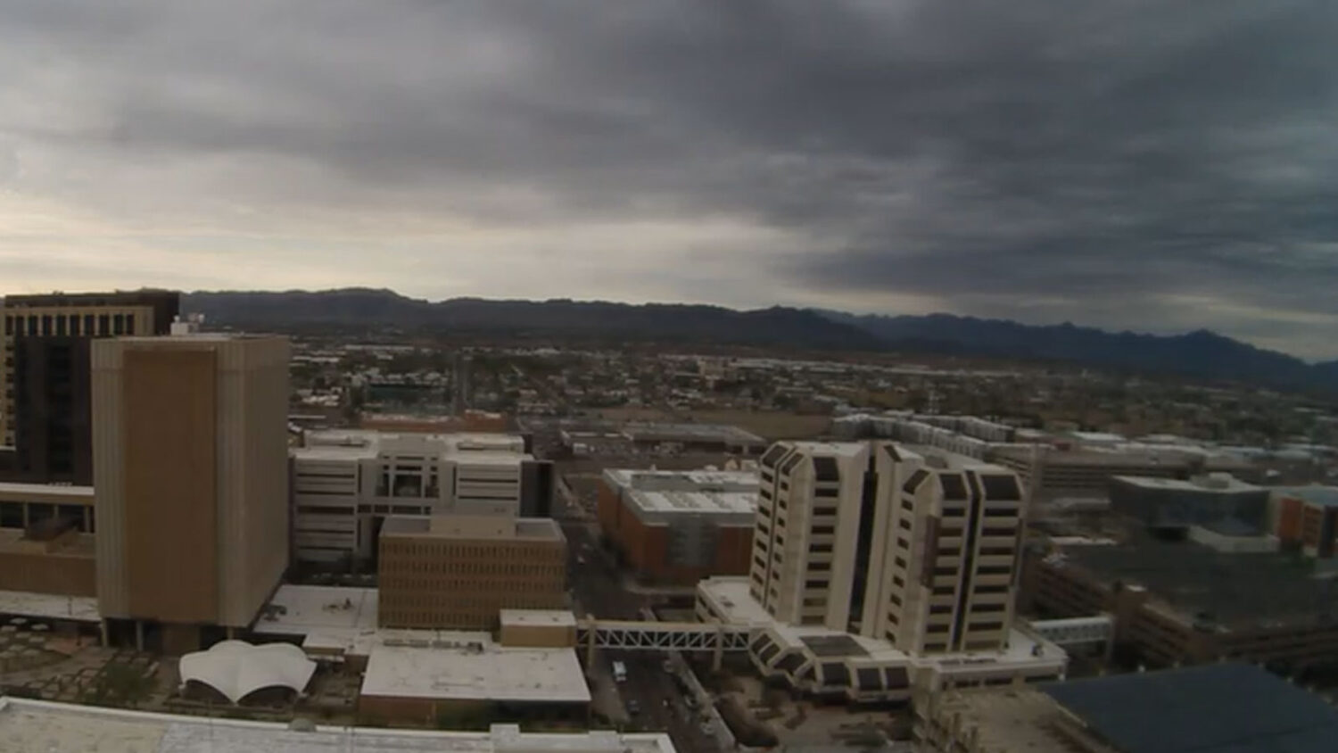
Dark clouds can be seen looming over Phoenix on Monday morning in this view from downtown. (PHX City Cam screenshot)
(PHX City Cam screenshot)
The Arizona monsoon season is going out with a splash as the workweek starts with rain and cooler temperatures in the forecast.
“We are looking at off-and-on light [and] maybe a little bit of moderate rainfall out there this morning and afternoon,” Chris Kuhlman of the National Weather Service in Phoenix told KTAR News 92.3 FM on Monday. “Rainfall amounts should be pretty light overall, upwards of maybe a quarter of an inch. Maybe this afternoon there might be a bit of heavy showers in a few areas, but it’s not going to be too bad today.”
Kuhlman said to expect a break in the evening before the action picks up late Monday and into Tuesday.
“That will involve some thunderstorms most likely, some heavier rain potential, and maybe rainfall amounts locally up to around an inch,” he said.
The higher terrains north and east of Phoenix could see larger totals of up to 2 inches, Kuhlman added.
Hurricane Polo pushes moisture into Phoenix area
The weather service said Hurricane Polo is pushing moisture into Arizona as it moves northeast and weakens, although the main track of the Pacific storm will be south and east of the state. A flood watch was issued for much of Arizona, although the advisory does not cover all of metro Phoenix.
28 Sep 2026 6:00 AM MST: The Flood Watch now includes La Paz County this evening into the overnight hours.
Flood Watches are in effect across much of the Desert Southwest through Tue evening. Regional travel will likely be impacted. Stay weather aware and plan accordingly! #azwx pic.twitter.com/W99xULits8
— NWS Phoenix (@NWSPhoenix) September 28, 2026
“We do have a flood watch out for northern parts of Phoenix, like Cave Creek, northern parts of Maricopa County and pretty much all the locations east of Phoenix. It’s in effect from midnight tonight through Tuesday evening,” Kuhlman said.
The storm activity is having a significant cooling effect. After Phoenix peaked at 100 degrees on Saturday and 97 on Sunday, highs are expected to be about 20 degrees cooler to start the workweek.
“Today, we’re going to be off and on [with] the light rain, definitely cloudy, highs only in the lower 80s. Tuesday should be the coolest day of the week with highs just [in] the upper 70s, around 80 degrees,” Kuhlman said.
Phoenix’s normal high for the end of September is 96 degrees.
Valley will dry out as monsoon season comes to an end
The Valley will start drying out and warming up Wednesday, which is the last day of the monsoon season.
“It will be a kind of slow warming process. We’ll still probably have highs in the 80s at least through Thursday, maybe even Friday, so we may not reach normal temperatures until sometime this weekend,” Kuhlman said.
Phoenix Sky Harbor International Airport, which the weather service uses for the city’s official readings, entered Monday having received 1.84 inches of rain since the 2026 monsoon season started June 15.
The airport would have to get hit hard in the next few days to reach the normal monsoon rainfall total of 2.43 inches.
Related
 As Arizona monsoon season winds down, all eyes turn toward El Niño
 ‘Amen,’ then a roar: Arizona church takes shelter amid tornado warning
 Families rescued from flooded Navajo Nation homes as Phoenix sees light rain
 Valley, eastern part of Arizona to get relief from weather activity after damaging storms
 Tornado warning issued near Show Low as watch in effect for other parts of eastern Arizona
 Heber residents face aftermath of potential tornado: ‘This puts me homeless now’

Comments
0 Comments