
Phoenix-area extreme heat warning probably will be extended again, NWS meteorologist says
Valley temperatures are expected to dip later in the week, but rising humidity will make it feel just as hot.

Watch: The truth about Arizona's water shortage and your bills | 11 mins
The ongoing Phoenix-area heat wave is showing no signs of letting up.
The Valley has been under an extreme heat warning since July 23. The warning has been extended several times already, and it probably will not end as scheduled Tuesday night, according to meteorologist Chris Kuhlman of the National Weather Service in Phoenix.
“It’s likely that the heat warning will be extended, probably even through the rest of the week,” Kuhlman told KTAR News 92.3 FM on Monday morning.
Why the Valley might feel hotter than the thermometer readings this week
Kuhlman said temperatures won’t reach record levels like they did over the weekend, but rising humidity will make it feel hotter than the thermometer reading.
“Today, we’re expecting highs in the Phoenix area of 111 to 114, and then Tuesday 110 to 113. But … the humidity’s going up, so it will feel just as hot even though the air temperatures are going down,” Kuhlman said.
Kuhlman explained that when moisture evaporates from the skin while the humidity is low, it cools you off. But higher humidity inhibits the cooling effect.
As a result, don’t expect to feel any cooler when temperatures dip later in the week.
“Our temperatures go down a little bit on Wednesday, I’d say highs of 108 to 110,” Kuhlman said. “However, as I said, the humidity goes up even further, like dew points in the 60s. So, it’s going to feel more like 110 to 115. And really, that’s not going to change probably through Friday.”
The moisture could lead to monsoon storm activity on Monday, but the best bet for rain is in high-terrain areas on the Valley’s outskirts.
Hot and humid conditions are expected thru most of this week. Higher moisture heading into tomorrow will lead to heat indices up to 110-120°F the rest of the week. Storm chances will be better this week, but still mostly confined to areas east and south of Phoenix. #azwx #cawx pic.twitter.com/VlK3WduKMj
— NWS Phoenix (@NWSPhoenix) August 3, 2026
“We are expecting potential for some blowing dust this evening in the Phoenix area, and maybe even like a 10% chance of some showers and thunderstorms late in the evening, around midnight,” Kuhlman said.
Any storms that develop Monday night won’t affect the forecast for the coming days.
“If it does happen, you know, it’s more or less not going to be extensive enough coverage of storms to really cool us off,” Kuhlman said. “I mean, it may cool us off temporarily, but it’s probably not going to … change what the temperatures will be on Tuesday or Wednesday.”
How does extreme heat affect the Phoenix area?
Extreme heat warnings trigger daytime closures of hiking trails at Camelback Mountain, Piestewa Peak and South Mountain in Phoenix.
“If we are having extreme heat like this, you want to avoid being outside during the hottest part of the day, like late morning through 6 p.m.,” Kuhlman said. “Wear plenty of sunscreen, be plenty hydrated, and wear loose-fitting clothing — all that kind of stuff.”
The danger is real. The Maricopa County Public Health Department has confirmed 40 heat-related deaths so far this year, more than double the number at this time in 2025.
The Maricopa County Heat Relief Network offers free, cool spaces and other resources to people who need relief from the heat from May to September.
Additionally, the Salvation Army opens 10 heat relief stations across the Valley during extreme heat warnings.
KTAR News 92.3 FM’s Colton Krolak contributed to this report.
Related
 Phoenix heat reaches record high Sunday with extreme heat expected through Tuesday
 Heat wave expected to bring record-breaking temps, heighten wildfire risk to parts of US
 APS sets all-time electricity demand record as extreme heat strains Arizona power grid
 Extreme heat warning for metro Phoenix extended ahead of potential record-setting highs
 Phoenix area wakes up to rain, lightning, thunder, power outages
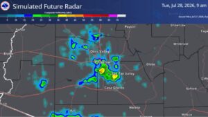 Storm activity could bring showers through the Valley Tuesday morning

Comments
0 Comments