
Monsoon winding down in, around Phoenix
The monsoon officially ends Wednesday and there was no rain in the forecast for several days.

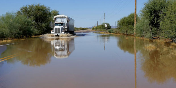
(AP Photo)
(AP Photo)
PHOENIX — The monsoon officially ends Wednesday and with no rain in the forecast for several days, it leaves behind 3.29 inches of rainfall in the past three-plus months. That’s about a half-inch above normal.
Paul Iniguez with the National Weather Service said the Valley has grown so much it’s not unusual for a summer to go by without a widespread thunderstorm event for the area.
“Sky Harbor (sit of the official rain gauge) was a relatively wet location, honestly, for the metro area. Most of the other places didn’t see that much.
“The heaviest rainfall we saw was downtown and toward north Tempe but there were other areas that got an inch or two. Very sporadic this summer.”
The Valley has endured — as usual — power outages caused by big rain and wind at least twice this summer.
Last summer Phoenix had almost 7 inches of rainfall but that was fueled mainly by the Sept. 8 storm that was the product of remnants from Hurricane Norbert.
Phoenix Sky Harbor had 3.29 inches of rain that day, by far the wettest on record.
Iniguez said this has been the second-warmest monsoon dating back to 1986. Phoenix averaged 94.6 degrees, slightly warmer than the norm of 93 degrees.
Related
 Trump urges calls to Arkansas Sen. Tom Cotton in push for permanent daylight saving time
 Man, woman seriously injured in shooting at Scottsdale home
 Arizona Corporation Commission issues cease-and-desist order against stablecoin sellerGovernor says Tennessee’s prisons chief is resigning after failed execution of Christa Pike
 A $28B hemp THC industry is fighting to save itself from a looming federal ban
 What to know about the investigation into Cornell University gang rape allegations

Comments
0 Comments