Active wildfires east of Phoenix area have burned around 100K acres
Aug 28, 2020, 12:06 PM | Updated: 12:36 pm
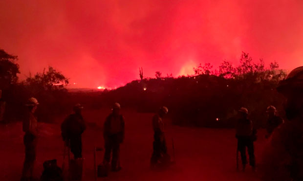
(Facebook Photo/Salt Gin Griffin Fire)
(Facebook Photo/Salt Gin Griffin Fire)

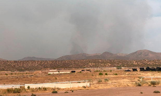
PHOENIX – Four active blazes east of the Phoenix area have consumed nearly 100,000 acres of land, as wildfires continue to wreak havoc in Arizona during an unusually weak monsoon season.
The largest of those, the Griffin Fire, had devoured 61,869 acres northeast of Globe in the Apache Mountains as of Friday morning and was 28% contained, according to officials.
The Salt Fire, a few miles east of the Griffin Fire, had consumed 21,670 acres and was 71% contained.
Just to the north of the Salt Fire, the Meddler Fire was at 4,452 acres and 20% containment.
RELATED STORIES

And the Superstition Fire, which is closer to the Valley in the Superstition Mountains east of Apache Junction, was up to 8,077 acres with 7% containment.
A long stretch of U.S. 60 between Globe and Show Low remains closed in both directions as a result of the Griffin Fire.
Several impacted communities on the east side of U.S. 60, including Johnson Ranch and McMillianville, remain under an evacuation order, and an evacuation shelter was activated at Lee Kornegay School in Miami.
Eastbound State Route 88 from northeast of Apache Junction to the Apache Lake area is also closed because of the Superstition Fire.
The Griffin, Salt and Superstition fires were sparked by lightning strikes last week.
The cause is still under investigation for the Meddler Fire, which started Monday.
More than 800,000 acres have been destroyed by wildfires in Arizona this year. Activity usually fizzles by July because of seasonal monsoon rainfall, but storms have largely failed to materialize.
That’s still short of the record 1.1 million acres lost in 2011, when the Wallow Fire along burned over a half million acres and the Horseshoe 2 Fire consumed 222,000 acres.
KTAR News 92.3 FM’s Jim Cross contributed to this report.