SRP unveils interactive map of historic sites, public art in Phoenix area
Jan 2, 2019, 12:49 PM | Updated: Jan 3, 2019, 8:33 am
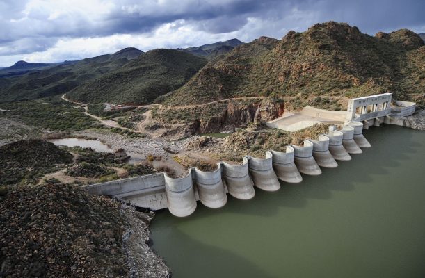
(SRP Photo)
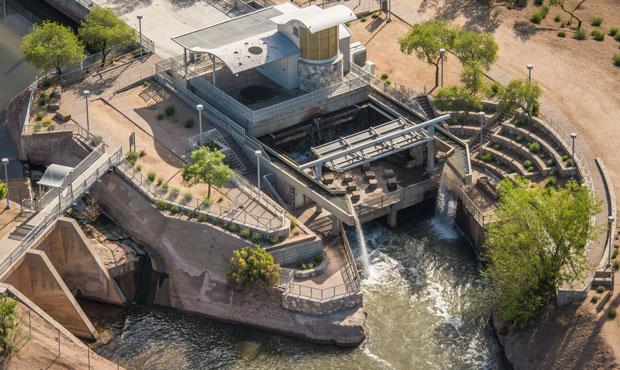
(SRP Photo)

PHOENIX – Salt River Project, metro Phoenix’s main utility company, recently unveiled an online resource with a treasure trove of information about the area’s history.
The interactive SRP Heritage Map, which was designed for use on mobile devices as well as home computers, provides details and photos for 75 historic sites in four sections: water system, power system, public art and other historic sites with an SRP connection.
“We have all this great information about the history of the growth of the Valley and different sites across the Valley that maybe people don’t notice or they don’t know about or they can’t see anymore because it’s no longer there that we wanted to share with the community,” Leah Harrison, SRP manager for research, archives and heritage, told KTAR News 92.3 FM on Wednesday.
Harrison said this is the first time SRP has mapped all the public art along its canal system.
RELATED STORIES

“So this is a really great opportunity for people to check out the map and see if there might be some really cool and interesting public art near their home or near the canal path that they jog every day,” she said.
Harrison said one highlight of the power system map is Arizona Falls, a historic hydroelectric generating site built in Phoenix’s Arcadia neighborhood in 1902.
In 2003, the facility reopened as a restored hydroelectric plant and community gathering place where visitors can learn about the system and enjoy the site’s three waterfalls.
“Artists went in to redesign it, and you can really experience the water flowing through the Valley at Arizona Falls,” Harrison said.
Users don’t have to be SRP customers to access the map, which has a location feature to make it easy to find nearby sites of interest.
“We really hope people use this to learn more about the community they live in,” Harrison said.
KTAR News 92.3 FM’s Nailea Leon contributed to this report.