Phoenix area hit with another round of dust storms Tuesday
Jul 10, 2018, 4:18 PM | Updated: Jul 11, 2018, 5:32 am

(Screenshot)
(Screenshot)

PHOENIX — Just one day after a massive monsoon engulfed the Valley in wind, rain and dust for the first major storm of the season, officials in Phoenix warned residents that another major weather event would take place on Tuesday.
The National Weather Service in Phoenix issued a dust advisory for parts of Maricopa and Pinal counties in south central and southeastern Arizona until 5:45 p.m. A flash flood warning was also issued for parts of Maricopa and Gila counties in east- and south-central Arizona until 7:30 p.m.
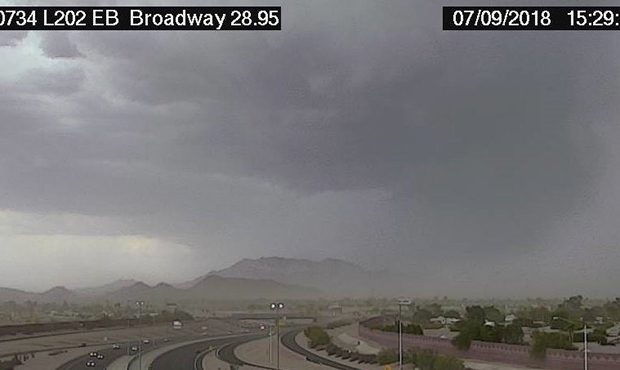
Cameras captured a large wall of dust extending from Arizona Mills Mall to seven miles southeast of Estrella Mountain Park to six miles southwest of Big Horn. It was moving northwest at 25 mph.
The dust storm has moved into downtown Phoenix! Watch our live #ValleyView cameras https://t.co/3cFxNaGOoJ pic.twitter.com/n64L9HcH9q
— Maricopa County (@maricopacounty) July 11, 2018
458 PM: Dust Advisory: The wall of dust continues to push northwest. Drivers in the hatched area use extra caution and pull aside if you encounter dust. #azwx pic.twitter.com/eeBlajExJc
— NWS Phoenix (@NWSPhoenix) July 10, 2018
Bianca Hernandez with the National Weather Service told KTAR News 92.3 FM that the dust was unlikely to bring the massive rain storm that residents saw on Monday, but warned that anyone driving on freeways in the area should pull aside in an attempt to stay safe.
“We’ve had pretty good activity down in southeast Arizona today and that’s starting to push toward the northwest,” she said. “As a result, there was an outflow boundary that’s now progressing toward the Phoenix area and it’s actually picking up some dust and producing a dust storm.
RELATED STORIES


“It looks like the wall of dust with some rain behind it, so there is a potential for some of these storms to creep into the Phoenix area, but it’s looking like the potential is there for the blowing dust and the dusty winds,” Hernandez added.
“It doesn’t look like we’re going to see the same thing that we saw yesterday today. Just remember, if you encounter the dust, pull aside. It’s really dangerous to attempt to drive through something like this.”
* STORM ALERT * The rain is falling in the West Valley. These photos show the I-10 at El Mirage and Avondale. #PhxTraffic pic.twitter.com/5ourVicD6Z
— Arizona DOT (@ArizonaDOT) July 11, 2018
The monsoon season officially kicked off June 15. Valley residents saw it in action Monday.
Many parts of the Valley had at least a half-inch of rain or more, with the area just south of downtown Phoenix receiving the highest rainfall total at 1.34 inches.
Both SRP and APS reported power outages as the storm rolled through, with more than 70,000 residents affected.
But it did not stop there: Heavy rain from a monsoon storm in southern Arizona reportedly caused a train derailment in Marana around 3 p.m. Tuesday.
Northwest Fire District officials said there was no indication any hazardous material spilled from the derailment, but debris was scattered across train tracks and a frontage road.
At one point, more than 2,000 Tucson Electric Power customers were without electricity because of the storm.
Company officials said crews quickly restored power to most of the homes and businesses.
However, there was some good news: The National Weather Service said the high temperature at Phoenix Sky Harbor International Airport on Tuesday was 98 degrees — about 9 degrees below normal.
KTAR News 92.3 FM’s Ali Vetnar and the Associated Press contributed to this report.